The people of Ilaje are a prominent and distinctive language branch of the Yoruba race, consisting of the Ugbo, Mahin, Etikan, and Aheri geopolitical units. According to history, they fled from their ancient ancestral home and settlement, Ile-Ife, in the tenth century. While a sizable portion of them dwell on land in the hinterland, they primarily inhabit Ondo State’s Atlantic coastline in Nigeria.
Ilaje is a local government area in Ondo State, south-west Nigeria, whose people are said to have spread across the coastal areas of Ondo, Ogun, Lagos and Delta states. However, the cities and towns of the other three geopolitical units, the kingdoms of Ugbo, Aheri, and Etikan, are dispersed along the beaches and marshy land of the Atlantic Ocean coast.
While the Ijebus are located to the west, Ikale to the north, and Itsekiri to the east form the borders of Ilaje, the Atlantic Ocean, on the other hand, serves as the southern border, with the APOI and Arogbo Ijaw serving as the northern border.
The Ilajes are without a doubt some of Nigeria’s most active and entrepreneurial people. Their remarkable adaptability and aquatic competence allow them to dominate their harsh geographic environment and use it to their advantage. As a result, they were able to construct substantial settlements like Ugbonla, Aiyetoro, Zion Pepe, and Orioke.
History
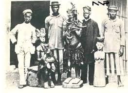
According to legend, the Ilajes fled Ile Ife, where they originally belonged, in the tenth century. While a sizable portion of them dwell on land in the hinterland, they primarily inhabit Ondo State’s Atlantic coastline in Nigeria. They currently reside in Ondo State, which is a seaport.
History has it that the deposed Olugbo Oba Mafimisebi claimed that they were the native Yoruba that was driven out of Ife. So far, he and the Oba of Benin were in agreement at the time, which, according to him, might have led to their leaving Ile-Ife.
Olugbo also confirmed that it is also the reason why Ugbo and Benin share chieftaincy titles called “Lema, Ashogbon, Oliha, Ojomo, and Yasere,” among others. It was the Yoruba language that was initially spoken by the Obalufon, Obamakin, Obalufe, Obawinrin, etc., including the Lingua Franca in the Benin palace.
History has it that before Oduduwa arrived in Ile-Ife in the 10th century, there were several ancient communities that included the Ilajes. Oduduwa arrived in Ife, where he immediately overthrew the local ruler and ascended to the throne as a monarch.
However, the forefathers of the Ilajes hated the Oduduwa’s autocratic leadership and moved via the Oke Mafunrangan forest to a location close to inmirin river, where they assaulted Ile-Ife for a protracted period of time, taking slaves and loot with them. The fabled Ife Queen, Moremi, was inspired by this invasion to set out on a valiant espionage mission that ultimately resulted in the defeat of the raiding aborigines.
A significant migration centre for the protesting migrants is the seaside village of Ugbo, which is ruled by Olugbo, the supreme monarch. Ugbo, which is commonly mistaken for Igboland in Southeast Nigeria, serves as the main setting in the Moremi mythology. Its complete meaning is “Mo r’ubo ni,” which translates to “I have a place to remain.”
Also, another supreme Lord who was important to the Mahin was the Amapetu. A degree of cultural blending can be seen in Ugbo, Mahin, and other places like Atijere, Obe-Nla, and Igbo-Egunrin, which may indicate a historical connection between the Ilaje, Itsekiri, and the Edo people.
Ilaje Territory
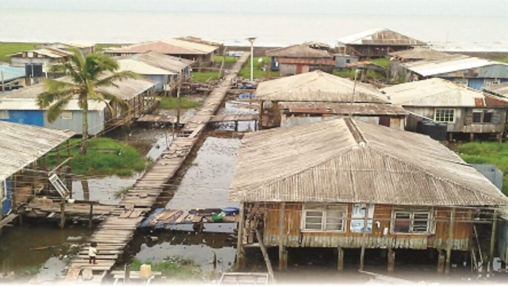
Ilaje Land has 1,318 km2 (509 sq mi) of land and 290,615 people as of the 2006 census, though it can be argued that the population was undercounted given the area’s riverine characteristics and lack of land or road access.
The Aheri and Etikan share a border with the Ijebus in the western sections. The Itsekiri people, who the Ilajes believe to be their cousins, share the eastern border with the Ugbos, the Yoruba-speaking Apoi and Arogbo Ijaws are found to the northeast in Ese Odo LGA, and the Atlantic Ocean forms the southern border. The Ikale to the northbound the Mahins.
One of Nigeria’s most vibrant and business-minded ethnic groups is the Ilaje. They were able to overcome their harsh geographic environment and use it to their advantage thanks to their aquatic prowess and capacity for adaptation. As a result, they were able to construct substantial settlements like Ugbonla, Aiyetoro, Zion PePe, and Orioke. Due to its early discovery of crude petroleum, Aiyetoro, for instance, had the highest per capita income in all of Africa during its heyday and attracted travellers, tourists, and scholars from all over the world.
The Trades of the Ilaje People
Aside from the mineral raw materials discovered in Ilajeland, and the petroleum that is present there, they are endowed with glass sand, salt, Tar sand/Bitumen, quartz, and clay. Fish, poultry, piggery, maize, palm oil, vegetables, timber, Rafia, poultry, copra, cocoyam, bananas, and cassava are examples of agricultural products. Large-scale rice crops and the salt industry may both flourish in Ilajeland thanks to its natural environment.
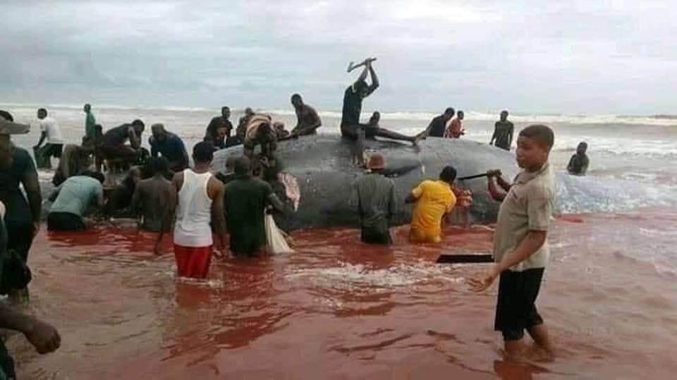
Furthermore, fishing, canoe construction, lumbering, net and mat manufacturing, launch building, farming, and commerce are among the Ilajes’ occupations. However, fishing continues to be Ilaje’s main agricultural concern. The fact that Ilaje’s geographic area boasts one of Nigeria’s longest beaches serves as more evidence of this. A common Ilaje proverb that reads, “Ubo eri pa to, Ilaje gwa to rin,” or “Wherever the river current runs through, there you will find the Ilaje,” highlights the Ilaje’s skill at fishing.
Numerous additional coastal communities in Nigeria, including Epe, Escravos, Warri, Badagry, Brass, and Nembe, are home to thousands of migrant Ilaje fishermen. Igbokoda, the seat of the Ilaje local government, is quickly becoming a hub of international commerce thanks to the traders it draws from throughout Nigeria and other African nations, particularly Togo, Benin, Ghana, Cameroon, and Gabon. Ilaje land is only around 75 kilometres from Lagos, and given the area’s water setting, tourism is a good fit.
However, the entire region was severely neglected and marginalized by the government in the past. Although Ilajeland is Ondo State’s only seaport, it appears that the state’s administration has begun to appreciate its significance as the region’s economic engine. The state has committed to supplying essential social facilities, including power and drinking water systems, along with a network of highways connecting the region with the hinterland.
Religion
The Ilajes embraced Christianity wholeheartedly with the arrival of the white missionaries, with a slight majority of them joining the Cherubim and Seraphim Church of Zion, which has its headquarters in Ugbo Nla, for worship. Additionally, there are a sizable number of Anglican and Jehovah’s Witness believers.
Festivals in Ilaje
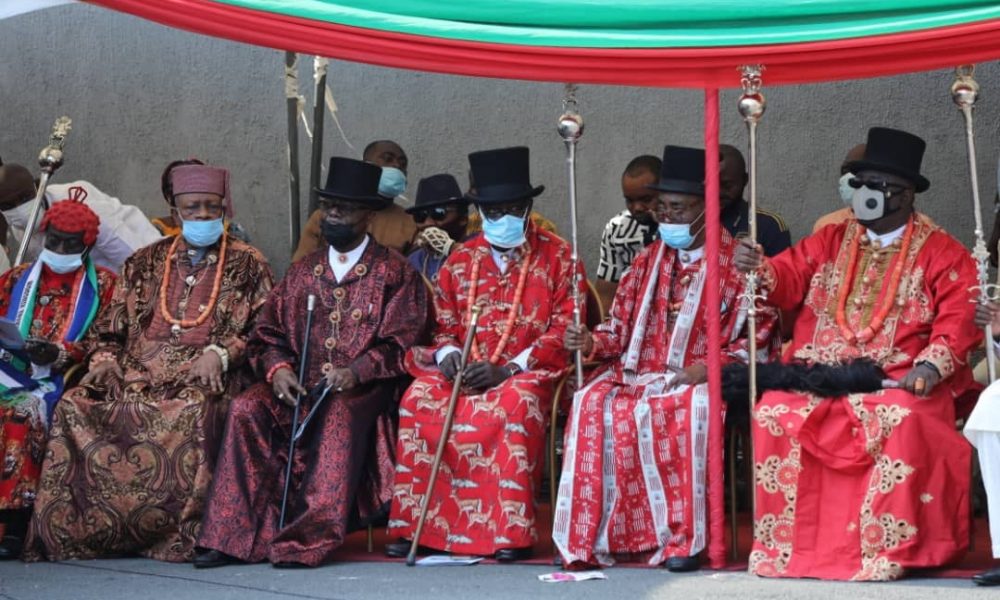
Even though the Ilaje are dispersed throughout the coastal regions, they regularly return to their home base in Ondo to celebrate their festivals, which include masquerading (the Umale festival), Malokun (a fertility festival honouring the goddess of the sea), regatta, and the Epo (a raffia-costumed masquerade), which was once used to frighten the Ife residents prior to the Moremi saga.
Both the Biripo traditional music and the Ilaje spirituals of the Zion Christian sect are performed during these events in their distinctively polyphonic versions. They are especially uplifting, and many upland Yoruba musicians attempt to emulate them in their works.
Also, in an Ilaje marriage setting, a court of young ladies from the bride’s home is chosen to entertain the guests at a typical Ilaje wedding ceremony where the bride is from Ilaje by performing the traditional biripo dance while using an obele (paddle stick).
Foods and Dressings of Ilaje People
Even though fish is a major part of every dish, there are some dishes that are cooked specifically. Only the Ilaje consume these items in a unique way, and the Pupuru and Obe Marugbo are among them. The Pupuru is manufactured from cassava and made in a manner akin to that of fufu. A unique variety of ground vegetables is used to prepare the Obe Marugbo. The Obe Marugbo is dark green in colour. The mashed yam and unripe plantain are prepared with palm oil (ogolale) and the Igbanyeghe, which is boiled maize with fish and palm oil added to various other Ilaje culinary condiments.
Furthermore, the Itsekiris or Urhobos are similar to how the Ilaje traditionally dresses, with a few variations. The women wear a shirt and a wrapper, while the men wear a wrapper with a buba top and a hat with a feather affixed to one portion of the hat. However, except for special occasions, the majority of Ilajes have adopted the traditional Yoruba manner of wearing in recent decades.
Modern-Day Ilaje
On October 1, 1996, the federal government reorganized the defunct Ilaje/Ese-Odo Local Government Area into the Ilaje Local Government. It has a space of 3,000 square kilometres and has more than 400 towns and villages.
Its northern border is with Okitipupa Local Government, its southern border is with the Atlantic Ocean, its western border is with Ogun State, and its eastern border is with Delta State. Troughs and undulating low land areas cover it. Silt, mud and shallow sedimentary deposits cover the extreme South.
The Lekki peninsula in Lagos State, Araromi Sea-side, Zion Pepe, Agba, Etugbo, Ipare All, Mahin, and Ugbonla in the western part of the local government area has sand formations. The eastern section of the local government area is home to the largest coconut plantation in West Africa.
It is traditionally divided into eight kingdoms, including Mahin Land, which is ruled by His Royal Majesty, Amapetu of Mahin, and Ugboland, which is ruled by His Royal Majesty Olugbo of the Ugbo Kingdom. Aheri land is governed by the Maporure, Etikan land is governed by the Onikan of Etikan, Odonla land is governed by the Alagho of Odonla, Obenla land is governed by the Olubo of Obenla, Obe Ogbaro land is governed by the Odoka of Obe Ogbaro, Igbokoda is governed by the Olu of Iggbokoda, and Igbo.
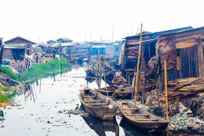
Nigeria’s Ilaje Local Government has a 180 km long coastline and is a popular tourist destination there. Numerous advancements in water transportation and the building of homes on partially or entirely inundated land are also major tourist attractions.
When the proposed coastal road from Lagos is finished, the distance from Lekki Peninsula in Lagos State to Ilaje Local Government along the Atlantic Coast will be around 30 kilometres. Igbokoda and Lagos may be reached by car in under three hours, passing through some of Benin. Lagos-Ibadan expressways, later known as the Shagamu. While residing in Lagos, it is possible to oversee business in Igbokoda.
A sculpture of a fisherman can be seen by visitors to the main beach of the Local Government Headquarters (Igbokoda). Hundreds of painted ferry boats can also be seen at the main beach, as though they were getting ready for a boat race.
The Local Government Area is home to a wide variety of cultural and traditional events and artefacts. For instance, the Local Government Headquarters is not far from the Ayelala Shrine, which is located at the river junction. Ayelala is a strong and well-respected goddess due to her potential, and wizards who fall into her hands are rumoured to publicly confess their faults.




Comments
Christopher olawumi olaniyi
4 years agoNice 👍 please always update me thanks