Nasarawa, often written Nassarawa, is a town located in north-central Nigeria. The Okwa River, a tributary of the Benue River, forks about north of the settlement. Around 1838, Umaru, a rebel official from the nearby town of Keffi, established Nasarawa as the capital of the new emirate of Nassarawa in the Afo, also known as the Afao tribe region.
In 1996, Plateau State, a neighbouring state, was split off to form Nasarawa State. Therefore, 13 local governments, including Awe, Akwanga, Doma, Karu, Keana, Keffi, Kokona, Lafia, Nasarawa, Nasarawa-Eggon, Obi, Toto, and Wamba, make up the state renowned as the “Home of Solid Minerals.”
Numerous ethnic groups live in Nasarawa State, including the Koro and Yeskwa in the far northwest; the Kofyar in the far northeast; the Eggon, Gwandara, Mada, Ninzo, and Nungu in the north; the Alago, Goemai, and Megili in the east; the Eloyi in the south; the Tiv in the southeast; the Idoma in the southwest; the Gade and Gbagyi in the west; and the Nasarawa has a mixed religious population, with roughly 60% of the people being Muslims, 30% Christians, and the remaining 10% practising traditional ethnic religions.
With a total land area of 27,137.8 square kilometres, Nasarawa State is bordered on the west by the Federal Capital Territory of Abuja; on the north by Kaduna State, on the south by the states of Benue and Kogi; and on the east by the states of Plateau and Taraba.
In this piece, Naijabiography explores the history and culture of Nasarawa State, including the political structure and trades of the people of Nasarawa.
History
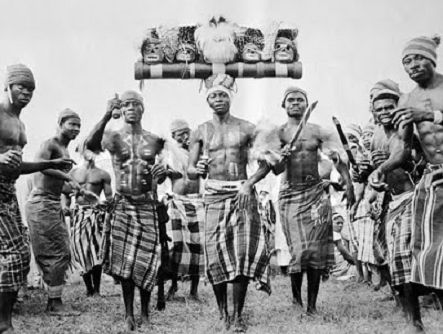
History has it that Nasarawa State was one of the six states established in 1996 by the military government of the late General Sani Abacha. The state was formed by carving from the former Plateau State, and since then, it has developed into one of the most popular tourist destinations in the country, which is thanks to its breathtakingly stunning scenery and breathtaking hills.
Nasarawa State at the time was said to have gotten its name from the historic Nasarawa Emirate, which was formed on October 1, 1996, from the west of Plateau by the legends who were part of the Emirates. After the creation of the state, Lafia was made the capital of Nasarawa and 13 local government areas were created, which are located in the east of the state. According to research, the Karu Urban Area, located at the western border of the Federal Capital Territory, Abuja, is known as the economic centre of the centre.
Until the early 1800s, when the Fulani jihad annexed the region and subsumed it under the Sokoto Caliphate as the vassal states of Keffi, Lafia, and Nasarawa, the area that is now Nasarawa State was divided up into various states, some of which were tiny and village-based while others were parts of larger empires.
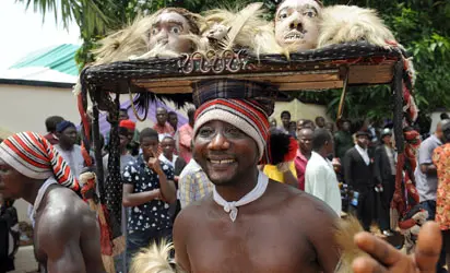
Around 1838, Umaru, a rebel official from the nearby town of Keffi, first established Nasarawa as the capital of the new emirate of Nassarawa in the Afo (Afao) tribe region. By capturing neighbouring lands, Umaru grew his empire. He also made Zaria the subordinate state of Nassarawa (175 miles north).
Muhammadu (reigned 1878–1922), one of his successors, expanded the emirate via numerous conquests and was one of the first emirs to swear allegiance to Great Britain in 1900. Nasarawa joined Plateau state in 1976; it joined Nasarawa state in 1996.
What is now Nasarawa State was a part of the new Plateau State after Benue-Plateau was divided in 1976 until 1996, when the western Plateau was separated to create the new Nasarawa State. With an estimated population of roughly 2.5 million as of 2016, Nasarawa is the second-least populated and fifteenth-largest in terms of area of Nigeria’s 36 states.
Furthermore, the state is primarily located within the tropical Guinean forest-savanna mosaic ecoregion. The River Benue, which forms a large portion of Nasarawa State’s southern border, and the state’s remote northeast, which contains a small portion of the Jos Plateau, are both significant geographic features.
Also, it is imperative to note that Nasarawa State was created during the administration of Sanni Abacha, which, according to research, his government split Nasarawa from what is now Plateau State which previously had contained both their territories.
People and Culture
With 1,869,377 inhabitants as of 2006, Nasarawa State was the second-least populous state in Nigeria, behind Bayelsa State.
Although there are numerous ethnic groups in Nassarawa, each has its own distinctive regional tongue. Thus, in Nassarawa state, Hausa is widely spoken and it is known as the primary language of the people. They all have similar social and cultural ideologies as well as a shared history.
Afo, Agatu, Akye, Alago, Baribari, Bassa, Egbira, Eggon, Fulani, Gade, Gbagyi, Gwandara, Hausa, Jukun, Kanuri, Mada, Ninzom, Arum, Rindei, Yeskwa, and Tiv are among the ethnic groups present in Nasarawa state.
Nasarawa people speak diverse languages aside from Hausa, which are spoken according to their local government areas. Some of the languages include Mada, Duhwa, Eggon, Fulani, Gwandara, Hausa, Mama, Ninzo, Numana, Nungu, Goemai, Lijili, Tiv, and Wapan, among others.
There are 25 different ethnic groups in Nasarawa State. These ethnicities include Miligi (Koro), Alago, Mada, Gwandara, Kunari, Hausa Fulani, Gwari, Rindre, Afo, Eggon, and Ebina, which are the most significant ones.
The Trades and Economy of Nasarawa State
The main occupations of the area’s mostly Afo inhabitants are farming and mining (for tin and columbite). In addition, yams, sorghum, millet, soybeans, shea nuts, and cotton produced nearby are sold at markets in Nasarawa.
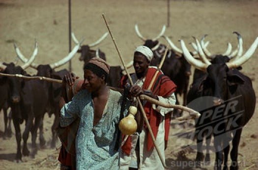
Although the state has faced challenges, especially the recent conflict between farmers and Fulani herdsmen, the predominant trade that helps to boost the economy of the state is its agricultural investment. Economically, Nasarawa people are mainly into agriculture, the rearing of livestock, and the ranching of cattle, goats, and sheep.
According to research, despite the conflicts between the farmers and herders in the state, Nasarawa has the nineteenth highest Human Development Index in Nigeria.
Religion
Although some traditional religions are still practised in Nasarawa State, Islam and Christianity are the two major religions there. Nasarawa has a mixed religious population, with roughly 60% of the people being Muslims, 30% Christians, and the remaining 10% practising traditional ethnic religions.
Modern-Day Nasarawa State
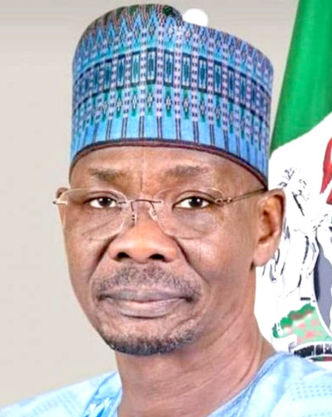
The Executive Governor of Nasarawa State, Abdullahi Sule, is also known as the Regional Executive of Nasarawa. Also, the state’s legislative house, the Nasarawa House of Assembly, is located in the capital city of Lafia.
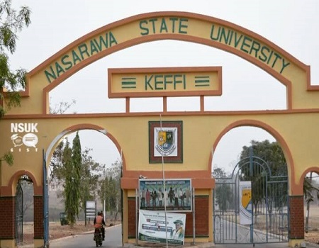
Furthermore, the state now has tertiary institutions, as well as primary and secondary schools, including colleges of education. The state has a college of education in Akwanga, Federal Polytechnic Nasarawa, a college of agriculture in Lafia, Isa Mustapha Agwai I Polytechnic Lafia, and Nasarawa State University.
In addition, the state also owns a Faculty of Agriculture at Lafia Campus, which was established recently. It also established the Federal University of Lafia, as well as the Mewar International University at Masaka, Bingham University at Karu, Hill College of Education Gwanje Akwanga, NACAP polytechnic Akwanga, Command Secondary School Lafia, and Command Secondary School Rinz.
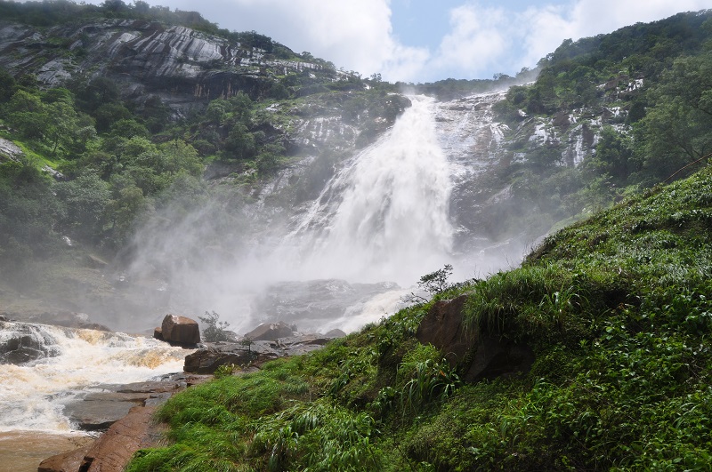
The modern-day Nasarawa State is a centre for tourists to explore and adventure. Research has shown that Farin Ruwa falls, located in the Wamba Local Government area of the state, is one of the highest falls in Africa. Another centre for tourism in the state is Maloney Hill.
Natural iodized salt is made in the Salt Village in the State’s Keana Local Government Area from a nearby lake. The town is also one of the main centres of Alago culture, one of the state’s most significant ethnic groups.
The hills of the Eggon people, which are located near Nasarawa Eggon, are also noteworthy. The Eggon people had settled on these hills and established them as part of their ancestry. Hiking is a popular activity for visitors on this stunning hill, which has a great view over the Nasarawa Eggon local government and the surrounding area.


